- Joined
- Aug 7, 2001
- Messages
- 54,631
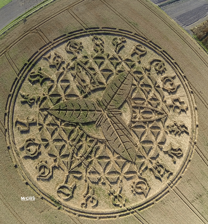
I used to know some parts of Essex quite well, but I couldn't place Roydon, so I had to look it up on Bing maps. The distinctive waterways and the River Stort shown in the photos made it fairly simple to pin down the site, and that matched with the Grid Reference (396094), which was reassuring!The Forests Way, Nr Roydon, Essex, 24th July
Looks a long way from home, this one.
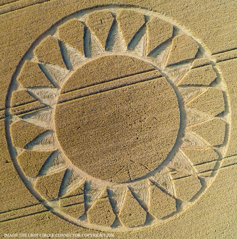
http://www.cropcircleconnector.com/2016/forestsway/forestsway2016a.html
If you want to get your bearings, look at the sixth picture on the page which shows a marina in (I assume) a flooded quarry. That Marina is NE of the Crop Circle site, and just south of the site is another flooded quarry called Glen Faba. Roydon is about a kilometre east of the site.
Sadly the aerial and Bird's Eye views don't show any evidence of crop circles, but they could have been taken at any time.