
blessmycottonsocks
Antediluvian
- Joined
- Dec 22, 2014
- Messages
- 9,457
- Location
- Wessex and Mercia
As a spin-off from the Tríbeč mountains thread, in which I mentioned compasses behaving anomalously, I referred to my own similar experience.
I already owned an antique brass compass, which is beautiful, but not the most practical device for hiking. I therefore treated myself to a modern military-style prismatic compass shortly after the first Covid lockdown.
My motives were quite simply the pleasure in using traditional navigation tools, rather than relying on Google maps, Strava or whatever.
I'd already used it for a few short hikes and had become comfortable with taking readings and map navigation.
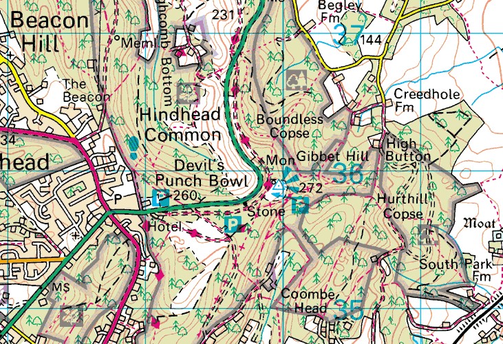
After the 2nd lockdown I decided to hike the Devil's Punchbowl trail in Hindhead Surrey. It's only around 3 or 4 miles, but I extended it by doing part of the adjacent Gibbet Hill hike first. So, I took my first bearing from the National Trust carpark and set off.
On the second half of my hike, I was just past the lowest point of the punchbowl depression maybe a mile or so west of the carpark and stopped for a gulp of water and to check directions back towards the carpark. It was not strictly necessary, as the trails are fairly well marked, but I did it for my own satisfaction. I knew that the carpark should be due east of my current position and the compass duly showed north as being to my left. With the compass still open, I kept watching it as I continued walking straight along the trail eastwards.
Strangely, the compass' needle strayed away from north and flicked around towards east. I backtracked several paces and the reverse happened.
When I repeated my steps and checked my reading using Google Maps though, nothing unusual occurred.
A quick Google reveals that the geology of the Devil's Punchbowl is primarily sandstone and clay. I haven't found any mention of substantial iron deposits and am a bit baffled as to the cause of this compass glitch.
Any ideas?
I already owned an antique brass compass, which is beautiful, but not the most practical device for hiking. I therefore treated myself to a modern military-style prismatic compass shortly after the first Covid lockdown.
My motives were quite simply the pleasure in using traditional navigation tools, rather than relying on Google maps, Strava or whatever.
I'd already used it for a few short hikes and had become comfortable with taking readings and map navigation.
After the 2nd lockdown I decided to hike the Devil's Punchbowl trail in Hindhead Surrey. It's only around 3 or 4 miles, but I extended it by doing part of the adjacent Gibbet Hill hike first. So, I took my first bearing from the National Trust carpark and set off.
On the second half of my hike, I was just past the lowest point of the punchbowl depression maybe a mile or so west of the carpark and stopped for a gulp of water and to check directions back towards the carpark. It was not strictly necessary, as the trails are fairly well marked, but I did it for my own satisfaction. I knew that the carpark should be due east of my current position and the compass duly showed north as being to my left. With the compass still open, I kept watching it as I continued walking straight along the trail eastwards.
Strangely, the compass' needle strayed away from north and flicked around towards east. I backtracked several paces and the reverse happened.
When I repeated my steps and checked my reading using Google Maps though, nothing unusual occurred.
A quick Google reveals that the geology of the Devil's Punchbowl is primarily sandstone and clay. I haven't found any mention of substantial iron deposits and am a bit baffled as to the cause of this compass glitch.
Any ideas?

 Forum members seem to encompass a wide variety and participate for different reasons. Some people believe lots of ridiculous stuff without much thought. It does not hurt to be the voice of caution on occasion. The audience will regularly ignore that voice anyway.