• We have updated the guidelines regarding posting political content: please see the stickied thread on Website Issues.

Earth Oddities Seen In Google Maps / Earth / Street View

special_farces said:
Excellent Street View panorama (well 2 stitched shots) and close ups. Was the russian version really called Concordski, or was that just in The Daily Mirror?? :)

I'm guessing it was a Tupelov but I haven't checked.....
 
Interesting. I love planes, didn't know the Russians had a 'Concorde'. Are they still flying?
 
The russians copied concorde as a technology bexercise, they wanted to prove they were better. The TU-144 was slightly faster, but they didn't get a good shape from the wing as we did. One crashed at the 1973 paris air show, they introduced a limited service but then retired them.

In 1996 the americans got one back in the air to research the possibility of having another go, but jacked it in. http://www.youtube.com/watch?v=VZSLgIrWo90

But there was never a market for it in russia because it could only do 5000 miles which had to be over over water whilst supersonic, so london or paris to new your was the only viable market.
 
Just an associated link for you - The Boeing 2707 (which won a government finance deal to develop) was going to become Americas first SST but the development was cancelled in 1971.
Previously the US had worked on a "swing-wing" SST concept (see the programme 'Planes that never flew') but never took it any further than the drawing board.

http://en.wikipedia.org/wiki/Boeing_2707

The item also contains links to the details for the TU-144 and Concorde.
 
Re: Weirdness in China

Monkfish said:
http://www.wired.com/dangerroom/2011/11/china-gigantic/

also here

40°26'59.35"N 93°23'0.20"E
If you zoom out, there are other strange markings to the left, one of which looks like a runway.
 
Riddle solved? Mysterious objects spotted by Google Map satellite in Gobi desert explained
By Rob Waugh
Last updated at 9:02 AM on 17th November 2011

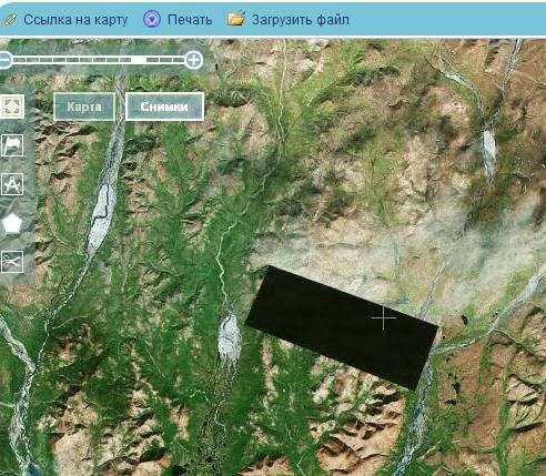
A Google Maps satellite spotted a series of bizarre structures during a sweep of the Gobi desert in China - and the mysterious objects sparked a wave of speculation that they could be anything from 'codes' to be read from space to practice targets modelled on US cities.

But it now seems likely that the structures are used to calibrate China's spy satellites, according to Natalie Wolchover of website Life's Little Mysteries.
She spoke to Jonathon Hill, a research technician at the Mars Space Flight Facility at Arizona State University, which operates many of the cameras used in Nasa's Mars missions - who said the symbols are near-identical to US targets used to calibrate Corona spy satellites in the Sixties.

The existence of these calibration targets may seem suspicious, but Hill said it really isn't; China was already known to operate spy satellites, along with many other countries, including the U.S.
'An [American] example I found just now is a calibration target for the Corona spy satellites, built back in the 1960s, down in Casa Grande, Arizona,' Hill told Wolchover.
'The grids of zigzagging white lines seen in two of the images - the strangest of the various desert structures - are spy satellite calibration targets. Satellite cameras focus on the grids, which measure approximately 0.65 miles wide by 1.15 miles long, and use them to orient themselves in space,' writes Wolchover.

The internet buzz around the objects has been intensified by the fact they are located on the borders of Gansu province and Xinjiang in northwestern China - an area that the superpower uses to build military, space and nuclear equipment.
There are burnt out cars and planes around some of the symbols, further fuelling speculation about a sinister military purpose. In fact, some of the sites are less than 100 miles from Jiuquan, where China’s space programme headquarters and launch pads can be found.

Some internet users had been trying to overlay one of the strange structures on to various U.S. city maps, worried that the symbols could be used as targets to allow China to target bombs and other weapons more precisely on U.S. cities.
Others pointed out that if China wanted to attack a U.S. city, it doesn’t need a practice map in the desert.

What was also fuelling the mystery was that it was just too difficult to tell what the structures are made of – whether they are painted on or dug into the landscape.
However, upon zooming in, planes and burnt-out trucks can be seen on some of the photographs, which hints that at least some of the symbols may be used in military training, or that they may indeed be targets of some kind.

This is the second time in a number of days that Google has published photographs of possibly secret facilities.
Last week the search giant published pictures of Iranian facilities which the UN says may be used to develop nuclear weapons.
Satellite images of Arak and Natanz show changes to the facilities in the areas when compared with images taken in October 2010.
The overhead pictures were released by Google following a report by the International Atomic Energy Agency which expressed 'serious concerns regarding possible military dimensions to Iran's nuclear programme'.

Read more: http://www.dailymail.co.uk/sciencetech/ ... z1dxMk0vH3
 
Zilch5 said:
An extraordinary collection of screen grabs from Google Earth's Street View project, hand curated by Montreal based photographer. A creative art project offering new perspective on our surroundings - from the bizarre to the beautiful

http://9-eyes.com/

Ha! I was happily scrolling through all that when I suddenly happened upon a picture from my hometown in The Netherlands!

After having lost count for the 6th time, I decided to just post the direct link to the image. Those who really want to can scroll through the 9-eyes page to find it. :)

http://s3.amazonaws.com/data.tumblr.com ... B3%2Fe8%3D
 
More street view stangeness:

Naked man spotted in car boot on Google Street View
A man has been captured on Google Street View apparently climbing into the boot of his car while naked.
10:21AM GMT 22 Nov 2010

The baffling picture shows a nude man in the boot of a Mercedes which is parked on the driveway of a house in Mannheim, south-west Germany.
A dog lies nearby surrounded by the contents of the sports car's boot.
The image has prompted a rash of internet speculation over what activity the man could be involved in.

One Internet user told the CNET website he thought it was just ''an illusion'' with the man wearing tight skin-coloured shorts while fixing his brake light.

However Google has removed the image from Street View, which only went live in Germany at the beginning of the month.

It is not the first time a Google Street View image has provoked debate.
In August a photo emerged of what appeared to be a dead schoolgirl laying on the side of the road in Worcester.
However, it turned out to be ten-year-old Azura Beebeejaun who was lying down playing dead with her friends.

http://www.telegraph.co.uk/news/newstop ... -View.html

..and the dog appears to have no bum or tail!
 
This is over a year old. The general belief is that he is wearing shorts and has climbed into his car boot to more thoroughly clean it. The parcel shelf can be seen to the left.
 
An amazing use of Google Earth:

Little boy lost finds his mother using Google Earth
By Robin Banerji, BBC World Service

Summary:
Lost and found
1981: Saroo is born
1986: He loses his family and ends up living on the streets of Calcutta
1987: He is adopted by an Australian couple and grows up in Tasmania
2011: He finds his home town on Google Earth
2012: He is reunited with his mother in Khandwa

Full story:
http://www.bbc.co.uk/news/magazine-17693816
 
Little boy lost finds his mother using Google Earth

If only it were always that easy.

:(
 
Seems that Google can't afford camera cars in Denmark.
:)
bike.jpg
[/img]
 
That's smart. That's probably how they're able to street view pedestrian zones in the cities.

Earlier they were only able photograph the roads in the cities. Recently I've noticed even pedestrian zones are street viewed.
 
Area in eastern Sibir hidden behind smoke or something else?

Goto: 66.266304,179.214478.

Just to show it isn't a simple Google Earth error, here's an image
from a Russian satellite:

Mystery_3.jpg
.

Found a thread about it on another forum, but thought it should to be
mentioned here as well.
 
The Bing Maps version also looks curiously edited. Seems to be no reason for it.
 
Back
Top